The New Shoreline at the End of the Heritage Trail Is Supposed to Look Unfinished
Last fall, while crews were still finishing the final stretch of construction, photographer Steve Lindberg caught a snowy owl landing on the new cobble beach along Lakeshore Boulevard, a few feet from where he stood. He got the shot. It's a good one: white feathers against gray stone, the lake gray-blue behind it. What makes the photo worth mentioning isn't the owl. It's the beach. Until recently, that stretch of shoreline was buried under a wall of broken concrete and mismatched rubble. Now it's rounded stone, and something with wings had already decided it was worth landing on before the project was even finished.
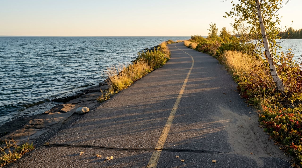
If you live along Lakewood Lane and ride the Iron Ore Heritage Trail north into town, you've probably made this trip a hundred times without thinking much about where the pavement ends. It merges into Marquette's Multi-Use Path somewhere past downtown, and if you keep going, the path hugs the shore all the way up to Presque Isle Park. That last stretch, the section of Lakeshore Boulevard between Wright Street and Hawley Street, has been under some phase of planning or construction for most of the last fifteen years. As of September 14, it isn't anymore.
The city held a ribbon cutting that Monday afternoon to mark the completion of the Lakeshore Boulevard Shoreline Restoration project. Officials from the city, the Superior Watershed Partnership, and Michigan's Department of Environment, Great Lakes, and Energy showed up to cut the ribbon on a project that has outlasted several separate construction phases and more funding rounds than most residents have kept track of. The planning started around 2012, with public meetings to figure out what to do about a shoreline that was actively falling apart. Construction stretched across multiple funded phases through 2024 and 2025. The result, now finished, is a 20-acre restoration that city and watershed partnership officials describe as the largest project of its kind on the Great Lakes.
The reason it took this long has nothing to do with red tape and everything to do with what was actually failing. Dennis Stachewicz, the city's longtime Director of Community Development, watched Lake Superior rise three feet over seven years while storms grew more frequent and more severe. The old fix was rock, dumped along the shore to hold the line. It worked until it didn't. By the time the city committed to a permanent solution, it was spending roughly sixty thousand dollars a year just patching the road that erosion kept eating into.
So in 2014, after that first round of community planning, Marquette decided to do something more drastic than another load of rock. It moved the road.
Here's the part that surprises people who bike past for the first time since the ribbon cutting: the new shoreline still looks rough. Jagged. A little raw. That's not a construction leftover. It's the design.
City Engineer Mikael Kilpela has described the new shoreline as a dynamic system, meant to reshape itself and move with wave energy instead of resisting it outright. Carl Lindquist, executive director of the Superior Watershed Partnership, put it plainly when asked about the sharp-edged stone visible right now: it will smooth into cobble over the coming years as the lake works on it. That's the intent. The old revetment was static, industrialized, essentially a wall. The new one is built to be worn down gradually into something that looks and functions like a natural beach, the same erosion process that shapes any cobble shoreline on Lake Superior, just given room to happen instead of being fought.
That distinction matters if you're the kind of person who notices things on your regular ride. This isn't a landscaping project waiting on a final coat of mulch. It's an engineered system, deliberately incomplete, that will keep changing for years. The version you see this month is not the version you'll see in five years, and both are working as intended.
The project unfolded in recognizable stages if you've lived here through any of it:
That last item is worth sitting with. The stone work is done. The path is open. But more than twenty native plant species, chosen in collaboration with the Keweenaw Bay Indian Community, haven't gone in the ground yet. If you ride through this fall, you're seeing the bones of the project. The fuller version, dune grass and wetland plantings included, arrives next spring and summer.
Skip the rocks-will-round-out explanation for a second and just think about what changed for anyone using the trail. There's a new lookout platform built into the restored section, a place to actually stop and look at the lake instead of riding past it. The bike path itself got extended as part of the project, adding usable distance to a route a lot of Lakewood Lane residents already treat as a default evening ride. And the section that used to be, in Kilpela's own description from when construction started, blighted and pretty industrialized, is now open ground you can walk down to and stand on, close to the water in a way the old rubble revetment never allowed.
Lindquist framed the broader value of the project as solving several problems in the same footprint: flood protection, shoreline stability, better fish and wildlife habitat, and improved recreation access, all from the same twenty acres of work. The owl on the cobble beach is one small piece of evidence that the habitat part is already showing up.
None of this requires a special trip. If you're already riding the Iron Ore Heritage Trail from the Lakewood Lane side, the route into town and up toward Presque Isle hasn't changed. What's different is what's waiting at the far end of it, in a stretch that spent most of the last decade behind construction fencing or buried under rock that had nothing to do with what a natural Lake Superior shoreline actually looks like. You've ridden past a work zone for years. Now you're riding past a finished, if still visibly rough, piece of coastline that's designed to keep evolving on its own.
If you're planning a fall ride, keep the calendar in mind: winter closures on the Presque Isle loop road kick in November 1, so there's a real window right now, while the weather still holds, to see this new stretch before the season changes the rest of the route around it.
It's not often that a fifteen-year municipal project produces something you can actually stop and look at on your regular ride. This one did. The rocks are supposed to look a little wrong for now. Come back in a few years and they won't.
Team Erin Wasik works and lives in this stretch of the Upper Peninsula, watching the same shoreline change as everyone else who rides it. If a home near this part of the trail is ever on your mind, not today, not urgently, just someday, Start Your Search with a team that already knows what's at the end of the ride.

Whether you're buying, selling, or investing, Team Erin Wasik provides personalized guidance backed by local expertise and modern marketing. We take a strategic, client-first approach to ensure every decision supports your long-term goals. Let's create a successful real estate experience together.

2854 Venture Dr, Marquette, MI 49855